Question: Write about the size of India.
Answer:
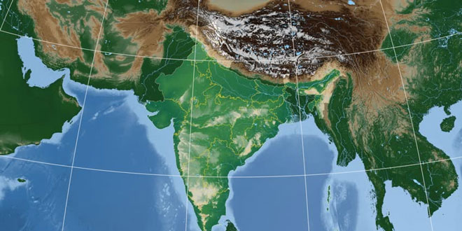
- The land mass of India has an area of 3.28 million (3.28 lakh) square km; which comprises about 2.4% of the total geographical area of the world. India is the seventh largest country in the world.
- The land boundary of India is 15,200 km. The coastline of the country is 7,516.6 km; which includes the Andaman and Nicobar and Lakshadweep.
- The latitudinal and longitudinal extent of India is about 30°. The time along the Standard Meridian is taken as the Indian Standard Time. The Standard Meridian of India passes through Mirzapur in UP which is located at 82°30’ east. The time lag between Arunachal Pradesh (in the east) and Gujarat (in the west) is about 2 hours. When one moves from south to north, the latitudinal extent influences the duration of day and night.
Question: “India’s land routes have been important since ancient times.” Explain.
Answer:
- India’s contacts with the world have continued through the ages, but her relationships through the land routes are much older than her maritime contacts. The various passes across the mountains in the north have provided passages to the ancient travelers.
- These routes have contributed in the exchange of ideas and commodities since ancient times. The ideas of the Upanishads and the Ramayana, the stories of Panchtantra, the Indian numerals and the decimal system thus could reach many parts of the world.
- The spices, muslin and other merchandise were taken from India to different countries. On the other hand, the influence of Greek sculpture and the architectural style of dome and minarets from west Asia can be seen in different parts of our country.
Question: What is latitudinal extent of India? How does it influence our lives?
Answer: The latitudinal extent of India is 6°4′ N to 37°6′ N. It influence our lives in the following ways:
- The Tropic of Cancer divides the country into two equal parts. Thus, India is situated in tropical and temperature.
- The northern part of India has high annual range of temperature whereas the southern part has low annual range of temperature.
- The latitudinal extent influences the duration of the day and night as we move from south to north.
Question: What is the ‘Prime Meridian’? What is the other name for it and why?
Answer: The Prime Meridian is the imaginary line used to indicate 0° longitude that passes through Greenwich Meridian because it passes through the place called Greenwich in London.
Question: What role Indian land route play in relationship of India with other countries?
Answer: The Indian land routes are much older than her maritime contacts.
- The various passes across the mountains in the north have provided passages to the ancient travelers while the oceans restricted such interaction for a long time.
- These routes have contributed in the exchange of ideas and commodities since ancient times. The ideas of the Upanishads and the Ramayana, the stories of Panchtantra,the Indian numerals, and the decimal system thus could reach many parts of the world.
- The spices, muslin and other merchandise were taken from India to different countries. On the other hand, the influence of Greek sculpture,and the architectural styles of dome and minarets from West Asia can be seen in different parts of India.
 Class Notes NCERT Solutions for CBSE Students


