Question: The Himalayas consist of three parallel ranges in its longitudinal extent. Name them.
or
Give a detailed description of the Himalayan Mountains.
Answer: The Himalayan Mountains:
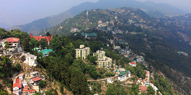
It is geologically young and structurally folded mountains which run along the northern borders of India. The ranges run from west (from Indus) to east direction (to the Brahmaputra) covering a distance of about 2,400 Km representing loftiest peaks in the world. Width varies from 400 Km in Kashmir to 150 Km in Arunachal Pradesh. Altitude (Height) variations is greater in the eastern half than those in the western half.
1. Himadri :
- The northern most range is known as the Greater Inner Himalayas or the Himadri.
- It is the most continuous range consisting of the loftiest peaks with an average height of 6000 meters including Mt. Everest.
- The core of this part of the Himalayas is composed of granite.
2. Himachal:
- The northern most range is known as Lesser or Middle Himalaya or the Himachal.
- Altitude varies between 3700to 4500m and average width is 50m.
- The Pir Panjal range forms the longest and the most important range. The Dhaula Dhar and the Mahabharat ranges are also prominent ones.
3. Shiwaliks:
- The outer most range is known as the Shiwalik.
- Its width is of 10-50 km and has an altitude varying between 900 and 1000 m.
- These ranges are composed of loose river deposits brought down by rivers from the main Himalayan ranges located for north.
The longitudinal valley lying between lesser Himalaya and Shiwaliks are known as duns. Dehra Dun, Kotli Dun and Patli Dun are some of the well known duns.
Question: Name the three types of plate boundaries.
Answer: Three plates are:
- Convergent plate boundaries: These are the margins where plates moves towards each other and the part of the crust is subducted into the asthenosphere .Thus, it leads to the destruction of the crust.
- Divergent plate boundaries: These are the boundaries were plate moves away from each other.It leads to the eruption of the magma from the asthenosphere and its solidification.Thus new crust is generated.
- Transform Boundaries: These are regions where plates slides pass each other without colliding.
Question: “The land of India displays great physical variation”. Explain.
Answer: The physiography of India shows huge variations:
- The North of the country is mountain capped: The Himalayas act as the northern boundary of India. The lowest mountains of the world like the Mt. Everest and Kanchenjunga are a part of the Himalayan range.
- The South of the country is a peninsula of the Indian Ocean: Thus, coastal climate prevails over the year. It is in stark contrast to the chilly low temperatures in the North.
- Te Western India is mostly a desert: The Thar Desert covers the states of Gujarat and Rajasthan where they hardly receive 150 mm of rainfall annually
- The Eastern India is a region of Plains and Mountains: The plains have several perennial rivers and also receive adequate monsoon rains. The North –East is again a hilly terrain. Mawsynram in Meghalaya records the maximum rainfall in the world
Question: Describe how the Himlayas have been divided on the basis of regions from west to east.
Answer: On the basis of regions from west to east and the rivers flowing, the great Himalayas have been divided into four divisions:
- Punjab Himalayas: This part lies between the Indus and Sutlej. They are also known as Kashmir Himalaya and Himachal Himalaya.
- Kumaon Himalayas: This part lies between Sutlej and Kali rivers.
- Nepal Himalayas: This part lies between the Kali and Tista rivers.
- Assam Himalayas: This part lies between the Tista and Dihang rivers.
 Class Notes NCERT Solutions for CBSE Students


